Beside the conservation of ecological networks the monitoring of these ecological sensitive areas is an important working area. At the moment there is a lake on available datasets for the prediction of which wildlife species are using the exiting ecological network and to identify areas with connectivity deficits.
On goal of the developed Ecological Network Application (ENA) is to generate data for monitoring purpose by citizens which are controlled and evaluated by wildlife ecologies.


The BETA version of ENA is now available for free on the Google Play store. Currently twelve different wildlife species which are relevant for the monitoring of ecological networks are supported. Furthermore the documentation of land use by taking standardized images is supported. A further functionality is the reporting of landscape elements with barrier effect. The mapping can by spatially restricted for single campaigns to reduce the data volume of the offline cache. Furthermore the mapping can be spatially restricted for single Points of Interest (POI) or transects. Navigation to the POI or along a specific transect is supported.

Eine detaillierte Beschreibung der Funktionalitäten finden Sie im Google Play Store .
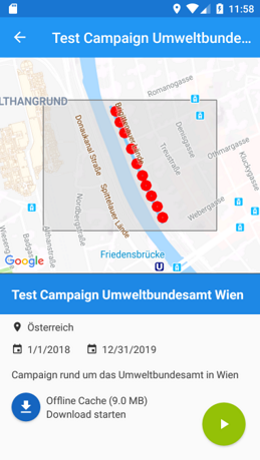
Select a campaign
Download maps for offline use
Start monitoring
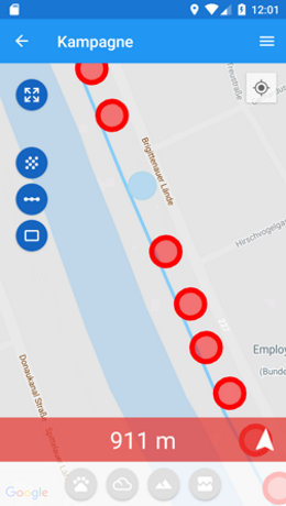
Free mapping or Points of Interest (POI) or transect based/restricted mapping
Select a transect or POI and navigate to the selected feature
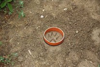
Mapping of wildlife foodprints / land use and barriers
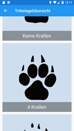
Wizard based mapping of footprints and fecesn

Augmented Reality gestützte Bestimmung der Trittsiegel

Upload of mapping results as soon as mobile data access is available
On the backend the configuration of mapping campaigns is supported. Based on this functionality we have the possibility to adapted specific mapping campaigns for different target groups (e.g. (for example elementary school | hunting association). After uploading the mapped data and an expert validation procedure the data are available in the portal. Please feel free to contact us if you are interested and need the configuration of a specific campaign.
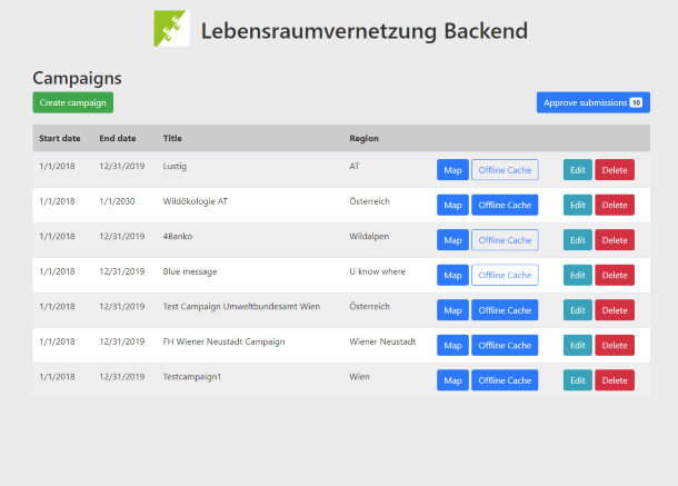
Configuration of campaigns for specific target groups
Configuration of map off-line cache
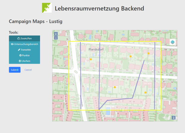
Define Area of Interest
Configuration of POI´s & transects
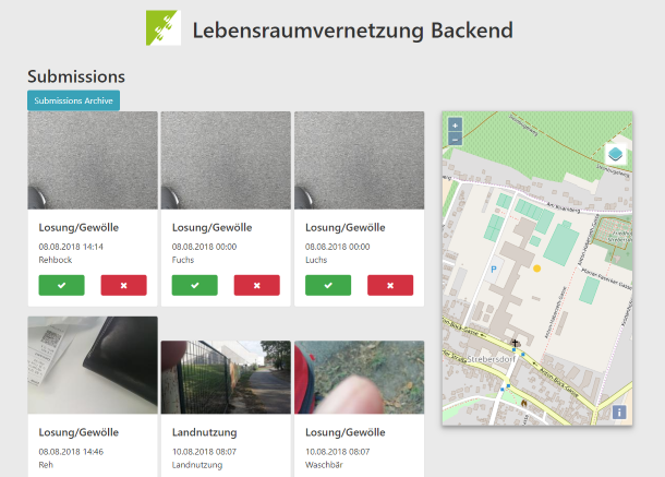
Expert based validation of the mapping results
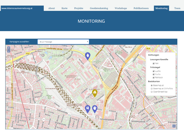
Results of the mapping campaign are direct available in the web portal after the validation procedure