ConNat

  • Overwiew Map ConNat
  • Detail Map ConNat 1
  • Detail Map ConNat 2
  • Detail Map ConNat 2

Project Title:
Connect Nature

Project Descirption:
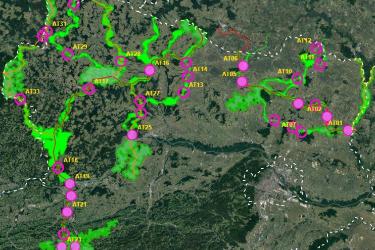
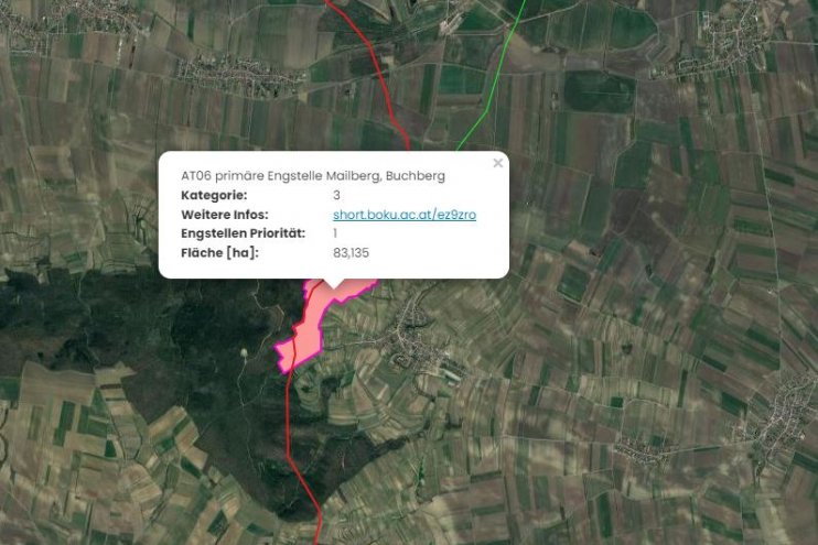
First of all, a GIS model was created, which aims to calculate the general course of the corridors as accurately and in as much detail as possible using a least cost path algorithm. In a next step, the results of the GIS model were used as a basis for further expert work. This offers the possibility to additionally take into account local specifics as well as findings from workshops, etc.

Contact person: 
Universität für Bodenkultur Wien
H85700 Institut für Geomatik
Franz Suppan, Mag.
eMail: franz.suppan@boku.at

H83200 Institut für Wildbiologie und Jagdwirtschaft (IWJ)
Alfred Frey-Roos, Dr.rer.nat.
eMail: alfred.frey-roos@boku.ac.at

Daten:
Data-download: https://boku.ac.at/rali/geomatics/themenfelder/fernerkundung-und-gis/connat-1/downloads

Bundesministerium für Land- und Forstwirtschaft, Klima- und
Umweltschutz, Regionen und Wasserwirtschaft (BMLUK)

Stubenring 1, 1010 Wien - E-Mail: service@bmluk.gv.at
© 2025 bmluk.gv.at - Alle Rechte vorbehalten